REVIEW · GUANAJUATO CITY
Guanajuato City: Hiking Tour at La Bufa
Book on GetYourGuide →Operated by TURISMO ALTERNATIVO EN GUANAJUATO · Bookable on GetYourGuide
There are hikes, and then there are hikes with a view mission. This La Bufa walk pairs Guanajuato’s landmarks with a real stretch of trail—about 14 km in roughly 4 hours—so you get fresh air and big skyline moments without wasting your day driving around. I love that the guide stitches together what you see with stories, starting at the dam de la Olla and continuing up toward the lighthouse. I also love the way the hike switches up the scenery through the hill, with stops for cacti, endemic plants, and panoramic breaks.
One possible drawback: it is not a stroll. The trek can feel challenging, especially on the descent, so plan on sturdy hiking shoes and a steady pace. If your group needs a slower rhythm, the guide can adjust, but your best move is showing up prepared.
In This Review
- Key things you’ll notice on this La Bufa hike
- The La Bufa route: why this hike feels special in Guanajuato
- Getting started: where you meet and how pickup usually works
- Dam de la Olla: history you can walk next to
- Toward the lighthouse: panoramic city views at the right time
- Into the hill: endemic plants, cacti, and a different Guanajuato mood
- Las comadres and el cerro de la bufa: the viewpoints that justify the effort
- Pace, terrain, and what to expect on the climb and descent
- What’s included, what’s not, and how to pack smart
- English or Spanish, and why the guide matters here
- Price and value: is $57 worth a 14 km, guided morning?
- Who should book this La Bufa hiking tour
- Should you book it
- FAQ
- How long is the La Bufa hiking tour?
- How far do you walk during the hike?
- Where do I meet for the tour?
- Can the tour pick me up from my hotel?
- Is the tour private?
- What languages does the guide speak?
- What’s included in the price?
- Is food included?
- What should I bring?
- Is it suitable for children or pregnant women?
- Are alcohol or drugs allowed?
Key things you’ll notice on this La Bufa hike
- Dam de la Olla start with clear, on-the-ground history before you even hit the trail
- Lighthouse panoramic views that frame Guanajuato’s old buildings from above
- Different feel on the way down, with terrain that can be trickier than the ascent
- Endemic flora and fauna spotting, plus photo breaks for plant details and cacti
- A true loop-style experience through Guanajuato’s hills instead of a simple out-and-back
- Private group flexibility, with a guide who can shift pace to your level
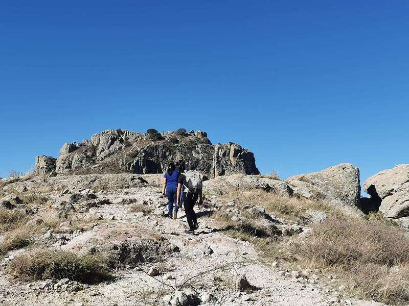
The La Bufa route: why this hike feels special in Guanajuato
Guanajuato is famous for its streets and architecture. But after a few hours inside town, you may start craving a different kind of scenery—space, air, and that moment when the city shrinks below you. This hike does that job fast. You start near the waterworks area of the dam de la Olla, then climb into the hills toward viewpoints like the lighthouse, before moving through the natural sides of the region.
The big win is how the hike is not just exercise. You’re walking a path where the guide points out what to notice: the plant life, the cactus shapes, and the small features that make Guanajuato’s surrounding hills feel distinct. One review specifically calls out that the guide paused often to explain the plants and cacti they were seeing and to take great photos. That turns the trail into something you can read, not just walk through.
Also, the views are the payoff. From above, Guanajuato’s old buildings and city layout look like they’ve been arranged on purpose. And in reviews, people consistently mention how impressive the peak-to-valley perspective feels—especially when the sky is clear and you can see the city and surroundings stretching outward.
You can also read our reviews of more city tours in Guanajuato City


Getting started: where you meet and how pickup usually works
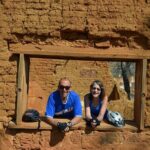
This tour is run by TURISMO ALTERNATIVO EN GUANAJUATO, and you meet at the office location (Las oficinas). The good news for planning: the start point can also work from your hotel, depending on where you’re staying. So if you’d rather not navigate town on your own before a climb, you can usually arrange a smoother handoff.
Before you move out, you can expect a safety briefing and practical orientation. There are also photo stops along the way to viewpoints. That matters because the route is not just one long grind; it’s built to give you moments to look, breathe, and take in the city as you go.
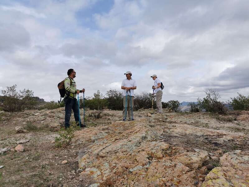
Logistically, it’s also a private group experience. That tends to make a difference on a trail: your guide can set a pace that fits your comfort level, rather than forcing everyone into the same speed.
Dam de la Olla: history you can walk next to
The hike begins with the dam de la Olla. This is one of those smart moves that keeps the tour from feeling like a generic “meet at the trailhead, climb, done” situation. You start with something local and specific, and you learn the history of Guanajuato as you’re standing near a real piece of infrastructure tied to the city.
Why this matters: it gives context before the views hit. When you later look out over Guanajuato, you’re not just seeing rooftops—you’re understanding how the city developed and how people shaped their environment. A good guide makes those connections feel natural, and here the guide stays with you throughout the route.
Another practical note: starting near a landmark can help you orient mentally. You get an early sense of direction and purpose, so the climb doesn’t feel like you’re simply being walked uphill. It feels like a story with a spine.
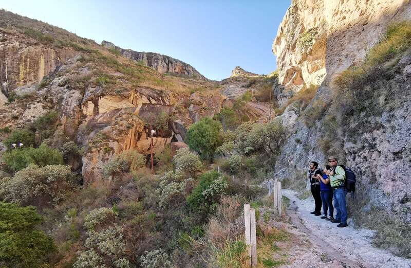
Toward the lighthouse: panoramic city views at the right time
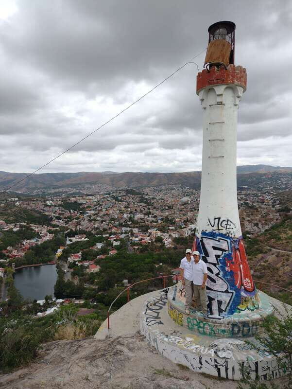
After the dam start, the route continues to the lighthouse. This is a key viewpoint on the climb, known for one of the best panoramas of Guanajuato and its historic core. You’ll get the kind of scene where the city looks packed with texture—steep streets, clustered buildings, and the sense that Guanajuato is built into its hills.
The lighthouse stop also tends to work as a mental reset. You’re hiking, learning, and scanning the terrain as you go. Then you reach this higher vantage and the guide can point out what you’re actually seeing. Reviews highlight how much information the guide gave during the hike, not just at the top. That’s the sweet spot: explanation that helps your eyes do their job.
Expect to take photos here. If you’re serious about shots, bring a phone or camera you can handle while moving. The tour includes photo moments, but you’ll still want to be ready when the best angle appears. The guide can also help you find a stable spot for pictures.
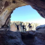
Into the hill: endemic plants, cacti, and a different Guanajuato mood
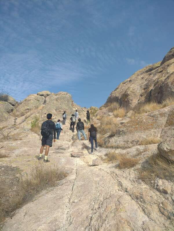
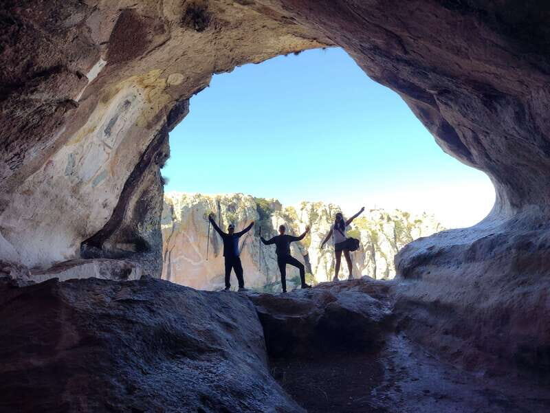
Once you start entering the hills, the hike shifts from city-facing views to nature-facing detail. This is where you’ll notice the endemic flora and fauna of the area. The guide should point out the plants and cactus you’re passing, and you’ll likely get pauses that are more than just “stretch here.” One review notes that the guide stopped multiple times to explain what plants and cacti they were seeing—and that those stops made the experience more enriching and memorable.
This section is also where the hike begins to feel distinctly “out of town,” which is a major part of the appeal. You’re not just hiking near streets. You’re moving through terrain shaped by the region’s natural growth—rocky edges, scrub-like vegetation, and cactus silhouettes that pop against the sky.
You might also see animals near the trail, including roaming cows and horses as mentioned in one review. It’s not guaranteed, but it’s a reminder that this hike has a living edge. Keep your eyes open, but stay focused on footing.
And yes, the views keep coming in bursts. You’ll trade wide panoramas for tighter, more intimate scenery as the trail bends and climbs.
You can also read our reviews of more hiking tours in Guanajuato City
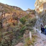
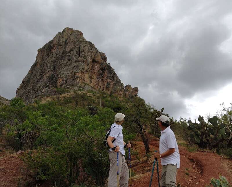
Las comadres and el cerro de la bufa: the viewpoints that justify the effort

As the hike continues, you’ll look for specific points that make Guanajuato’s natural side feel unmistakable—places such as las comadres and el cerro de la bufa. These names matter because they point to landmarks hikers recognize, and they tend to mark moments when the terrain changes and the view opens again.
From the feedback you’ll get from other hikers, the summit and peak moments are where people feel the biggest payoff. One review calls the scenery stark and beautiful, another emphasizes the view from the peak into the valley, and another highlights that the guide explained the history of the place at the top along with other interesting details.
This is also a good place to use the guide’s expertise. If you’re the type who enjoys knowing what you’re looking at, you’ll appreciate the way the guide connects landmark names with real features and plant life. The tour’s promise is that you’re taken somewhere you’d likely skip on your own—less because it’s impossible to find, and more because you wouldn’t know where to look.
Pace, terrain, and what to expect on the climb and descent
This hike is listed as lasting 4 hours total, with about 14 km walked. Reviews consistently describe it as tough enough to earn your effort. That doesn’t mean it’s for expert athletes only, but you should treat it as a proper hike.
One pattern shows up in reviews: the ascent can feel more pleasant, while the descent can be more complicated. That’s common on routes where the return path is steeper, rockier, or just changes underfoot conditions. If your plan is to take photos, you’ll want to do it while standing securely. If you’re moving slowly, your best friends are short steps and careful foot placement.
The good part is that the guide adjusts pace. Multiple reviews mention that Raúl slowed things down when needed and kept the group safe on the climb and back. That makes this hike more approachable than a fixed “march up” tour.
Also, because it’s a loop-style route (with different paths up and down mentioned in reviews), you won’t get bored watching the same scenery repeat. You’ll get a different feel on the way back, including changes in vegetation and atmosphere.
What’s included, what’s not, and how to pack smart
This tour includes several useful items that help you hike with less hassle:
- Walking sticks
- Specialized guide (English or Spanish)
- Required permissions and entries
- Transfer to the place of start and return (depends on your hotel)
- Mechanical support
- First aid and insurance coverage
- Civil liability and personal accident insurance
- Amphora (included item)
Food is not included, so plan a snack strategy if you get hungry. With a 4-hour hike, many people like to eat before you start and carry water. The tour doesn’t mention a water plan, so bring your own bottled water if that’s your style.
What to bring is straightforward:
- Passport or ID card
- Comfortable clothes
- Comfortable shoes or hiking shoes
Quick reality check: you’ll be tempted to wear the “nice” shoes you planned to keep for town. Don’t. If you only pack one improvement, pack better grip. The descent is the moment shoes matter most.
Not allowed:
- Alcohol and drugs
And it’s not for everyone:
- Children under 5
- Pregnant women
English or Spanish, and why the guide matters here
This is a private group hiking tour with a live guide in English or Spanish. That language option matters because you’re not just walking between points; you’re learning what you’re seeing. When the guide can explain plants, cacti, and landmark context, the trail becomes more satisfying.
The name you’ll hear is Raúl. Reviews highlight that he provided a lot of history and details along the way and that he was attentive—stopping for plant explanations, taking photos, and adapting pace so the hike stayed enjoyable.
If you’re the type who likes to understand a place instead of just photographing it, this guide-led approach is one of the main reasons to choose this hike.
Price and value: is $57 worth a 14 km, guided morning?
At $57 per person for about 4 hours and roughly 14 km, the price is fairly solid if you care about two things: guidance and the fact that this is not just a walk through the easiest urban bits.
Here’s the value angle:
- You get a specialized guide (with English or Spanish).
- You get walking sticks, plus first aid and insurance coverage.
- You get transfer to and from the start when your hotel location allows it.
- You get a route that includes landmark stops like the dam de la Olla, a key viewpoint at the lighthouse, and hill highlights like las comadres and el cerro de la bufa.
What you don’t get is food. But for a half-day hike, that’s common. If you plan your own snack and water, you can keep the cost sensible.
If you were to do this solo, you’d likely spend time figuring out the best viewpoints and where to safely walk through the hills. The guide saves that mental work and helps you notice details you’d miss on your own.
Who should book this La Bufa hiking tour
This is a great fit if you want:
- Real time outdoors without leaving Guanajuato for a full-day escape
- A guided experience that explains plants, cacti, and local context
- City views plus nature time in one block
- A private-group pace that can slow down if needed
It’s less ideal if you:
- Want a low-effort hike
- Have trouble with uneven footing
- Need an experience that’s stroller-friendly or very kid-friendly (it’s not suitable for children under 5)
- Are pregnant (not suitable)
If you’re visiting Guanajuato for architecture and street vibes, this hike adds a second side of the city. It makes your trip feel more complete.
Should you book it
Book this tour if you’re chasing the best kind of Guanajuato combo: dam-to-viewpoint history, then a hill hike with cactus and endemic plants, and then that summit look over the valley. The consistent praise for Raúl’s knowledge, careful pace adjustments, and frequent plant explanations is exactly what you want when you’re paying for an experience—not just footsteps.
Skip it if you want a gentle outing or if you don’t have supportive shoes for a tougher descent. Think of this as a half-day workout with strong visual rewards, not a casual stroll.
If you want your Guanajuato day to feel different on purpose, this one delivers.
FAQ
How long is the La Bufa hiking tour?
The duration is 4 hours.
How far do you walk during the hike?
The total distance is approximately 14 km.
Where do I meet for the tour?
You meet at the tour operator offices (Las oficinas).
Can the tour pick me up from my hotel?
Pickup and return transfer depend on where your hotel is located.
Is the tour private?
Yes. It’s a private group experience.
What languages does the guide speak?
The guide is available in English and Spanish.
What’s included in the price?
Included are walking sticks, amphora, specialized guide, required permissions and entries, transfer to and from the start (depending on your hotel), mechanical support, first aid, and insurance coverage.
Is food included?
No. Food is not included.
What should I bring?
Bring your passport or ID card, comfortable clothes, and comfortable shoes or hiking shoes.
Is it suitable for children or pregnant women?
It is not suitable for children under 5 years, and it is not suitable for pregnant women.
Are alcohol or drugs allowed?
No. Alcohol and drugs are not allowed.